
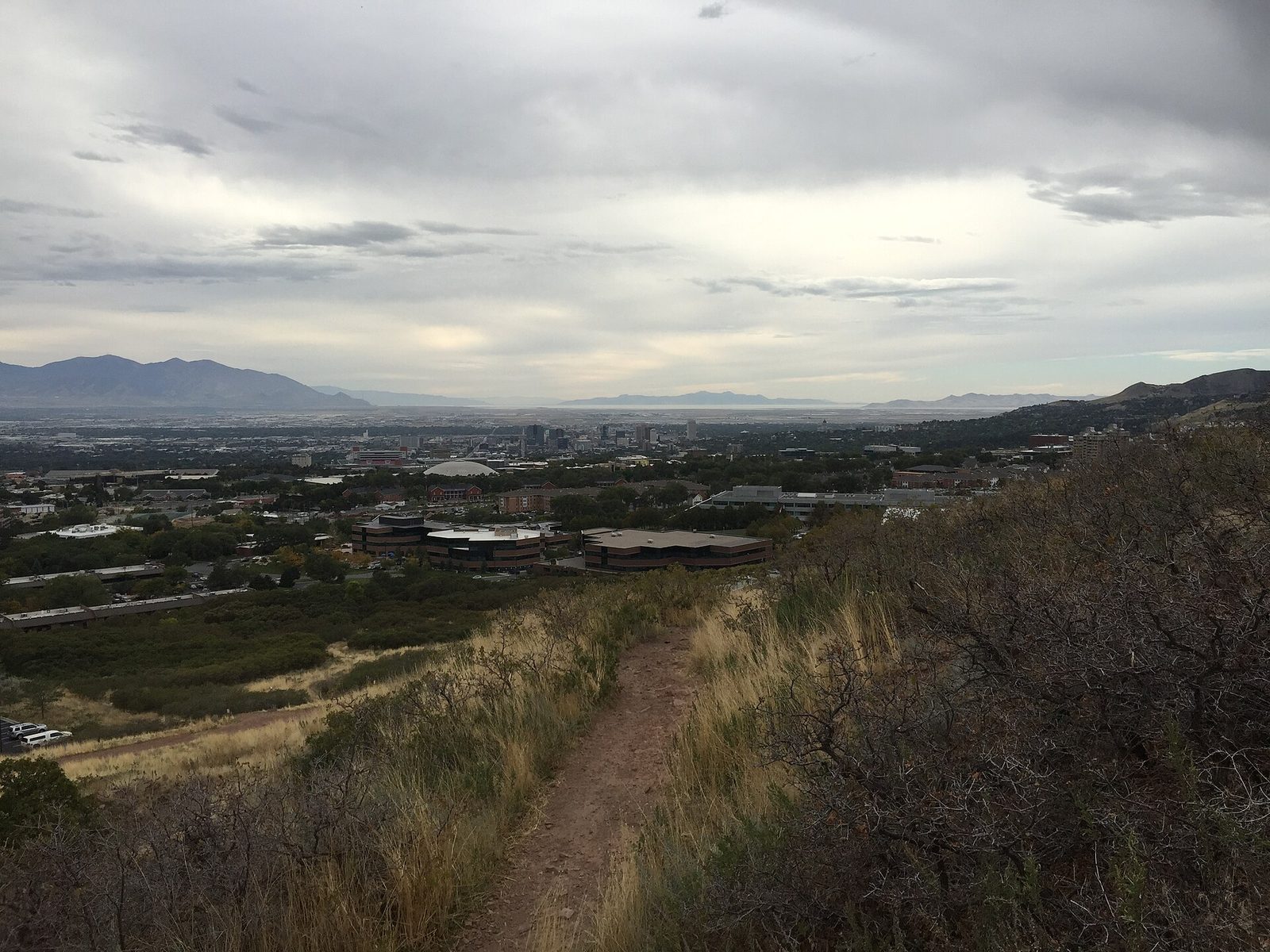
🏔️ Salt Lake City, the base for Utah's Mighty 5
Salt Lake City has two jobs in this hub, and they need different planning. The first is a compact, genuinely visitable capital: a five-block temple square at the centre of a street grid that was laid out around it, a state capitol on the hill above, museums in the foothills, and an airport light-rail line that lands you downtown inside a zone where the trains run free. The second job is bigger: this is the northern gateway to Utah's Mighty 5 — Zion, Bryce Canyon, Capitol Reef, Canyonlands and Arches — the five national parks the state tourism office builds its signature road trip around. Like Sedona and Flagstaff in our Arizona system, this page is built as [base + region]: Salt Lake City is where you arrive, sleep the first night and pick up the car; the parks are a southern region you then cross by moving your base — Moab, Torrey, the Bryce country, Springdale — not a set of day trips you commute to. This page covers both jobs honestly, including the reservation facts for the parks as the National Park Service states them for 2026, with no prices, distances or drive times stated anywhere.
The lay of the land — one base city, one southern region
Read the trip in two storeys. Downstairs is the city itself: Temple Square at the grid's origin, the Capitol uphill, the foothill museums east, the lake west — a day or two that needs no car. Upstairs is the region: a one-way arc through southern Utah that the Utah Office of Tourism itself publishes as a week-long itinerary beginning in Salt Lake City. The mistake this page exists to prevent is sleeping in Salt Lake City and commuting to the parks. The table is the map; the cards below carry the detail.
| Piece | What is in it | How it works | Watch out |
|---|---|---|---|
| Downtown base | Temple Square · the Free Fare Zone · downtown hotels and the TRAX web | Walkable, with TRAX free inside the zone and the airport train landing in the middle of it | The Salt Lake Temple itself is closed for renovation — the square is open, the temple is a 2027 story |
| The hill & the foothills | Utah State Capitol · City Creek Canyon · the natural history museum side | A half-day layer above and east of downtown, by bus, TRAX or a short drive | It is uphill in both directions of the day — pair it with a downtown morning, not a park departure |
| The lake | Great Salt Lake shore and its state parks, west of the city | A driving half-day — the city's horizon, not its centre | Lake conditions change by year and season; the state parks' pages are the current word |
| The Mighty 5 region | Moab (Arches · Canyonlands) → Torrey (Capitol Reef) → Bryce Canyon → Zion | A moving-base road trip south, in the state tourism office's own published order | Each park has its own local base — moving your pillow is the system, not a failure of planning |
The base city — the square, the hill, the lake
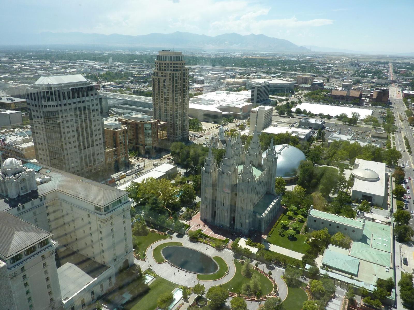
Temple Square Historic & faith centre — downtown
Strengths
- The literal centre of the city: five downtown blocks of gardens, historic buildings, museums, libraries and performance spaces gathered around the Salt Lake Temple — and the point from which the city's street grid and addresses are reckoned, which makes it the easiest orientation device a visitor gets
- Admission is free and the square is open daily on the Church's own visitor pages; the new Temple Square Visitors' Center is the current front door, with exhibits and a scale model that shows the temple's interior while the real one is closed
- The Church runs a short "Inside a Temple" experience in the visitors' centre — replica rooms with a guide — which answers the question every visitor actually has, honestly, while temples are closed to the public
Watch out
- The temple itself has been closed for a major renovation since 2019: you visit the square, the gardens and the visitors' centre, not the temple interior — the public open house, when the renovated temple can be toured, is scheduled for April to October 2027, and needs its own reservation when bookings open
- The one reservable piece is that replica-room tour: the Church asks for a reservation for it through its Temple Square site or app, released in batches — walk-in works for the square, not necessarily for that tour on your day
- This is a place of worship first and a sight second: dress, photography and programme patterns follow the host's rules, and the Church itself is clear that a temple is not a Sunday worship chapel — the two are different buildings with different doors
Best for: the arrival day — orientation, gardens and the city's founding story in one walkable block, before the trip turns south.
See Temple Square →Official site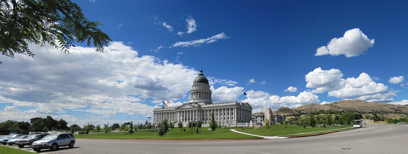
Utah State Capitol & the hill Civic landmark — Capitol Hill
Strengths
- The city's second orientation point: the capitol crowns the hill directly north of Temple Square, and the Utah Office of Tourism's own city itinerary strings them together — square, then uphill to the capitol and its museum, then down into City Creek Canyon — as one walkable half-day
- The view is the exhibit: from the hill you can read the grid, the valley and the lake's direction in one look, which quietly organises the whole rest of the trip
Watch out
- It is a working seat of government: access, tours and hours follow the legislature's calendar and security rules, stated on the capitol's official pages rather than here
- The hill is a real hill — in summer heat or winter ice, the climb is part of the plan, and the canyon descent is a walk, not a shortcut back
Best for: the second morning — civic Utah above, the grid explained below, and City Creek's green corridor as the way down.
See Visit Utah's Salt Lake start →Official site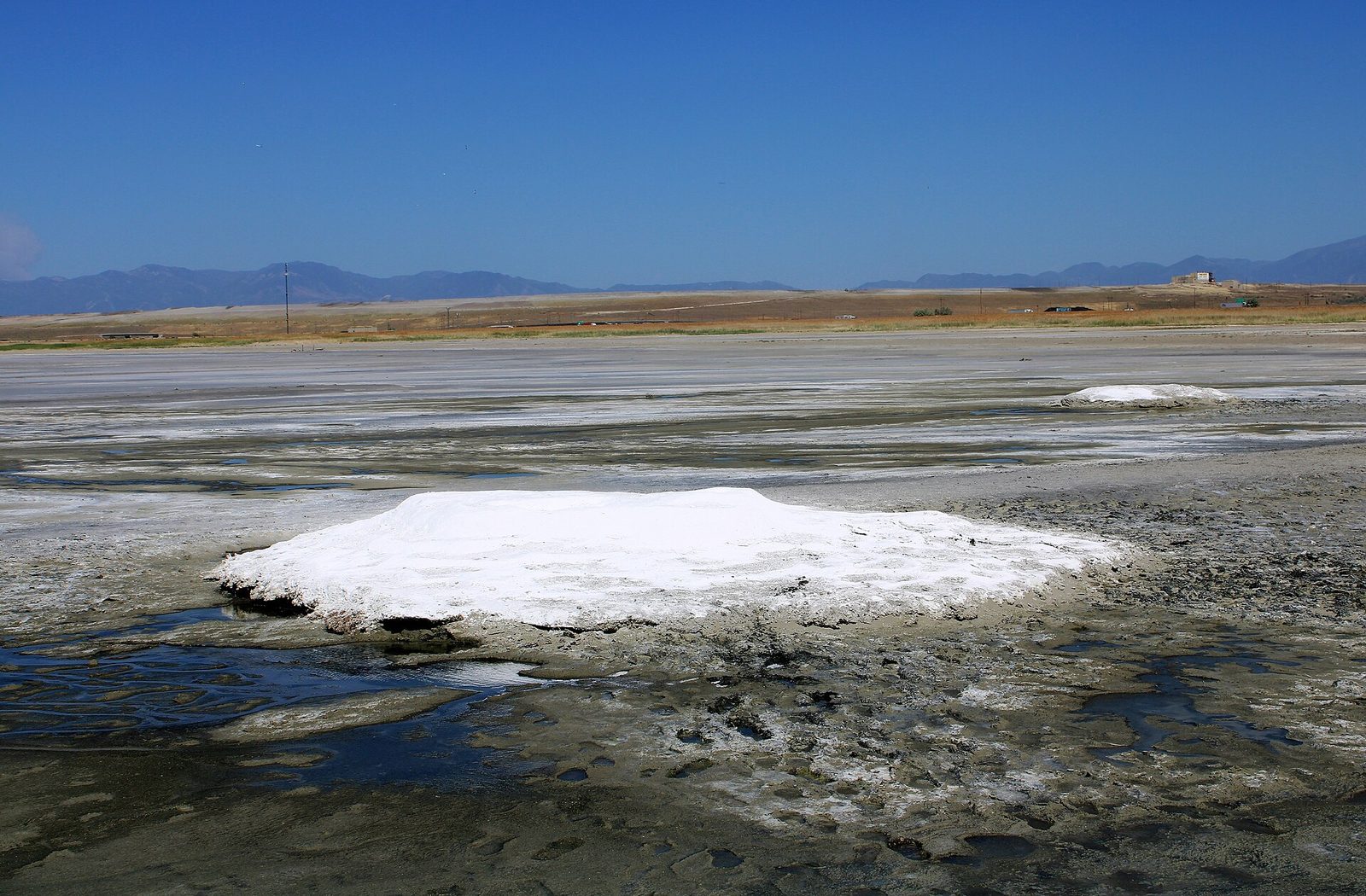
The Great Salt Lake shore State parks — west of the city
Strengths
- The namesake itself: the lake that named the city sits on its western horizon, and the state parks on its shores are the standard first encounter — open water, salt flats at the edge, mountain islands on the skyline
- It is the city's only half-day that feels like leaving the continent: a shore visit pairs naturally with a park-departure day as the calm before the red rock
Watch out
- This is not an ocean beach and should not be sold as one: it is a shallow, salty, changing lake whose shoreline moves with the years — what the shore looks like is a question for the state parks' current pages, not for any guide's photograph
- It needs the car (or a tour): the lake layer is exactly where the city's otherwise strong no-car pattern ends
Best for: a late afternoon on the arrival side of the trip — sunset over the water, then downtown for dinner.
See Visit Utah →Official siteThe region — the Mighty 5, in the order the state itself drives them
The Utah Office of Tourism's published itinerary "Salt Lake to The Mighty 5" begins in the city and then runs Moab first, Zion last — saving the biggest canyon for the end. The cards below follow that order. What each park demands of you is stated the way the National Park Service states it for 2026; fees and pass questions are deliberately not answered here, because the pass math belongs to our budget calculator and the parks' own pages, not to a city course.
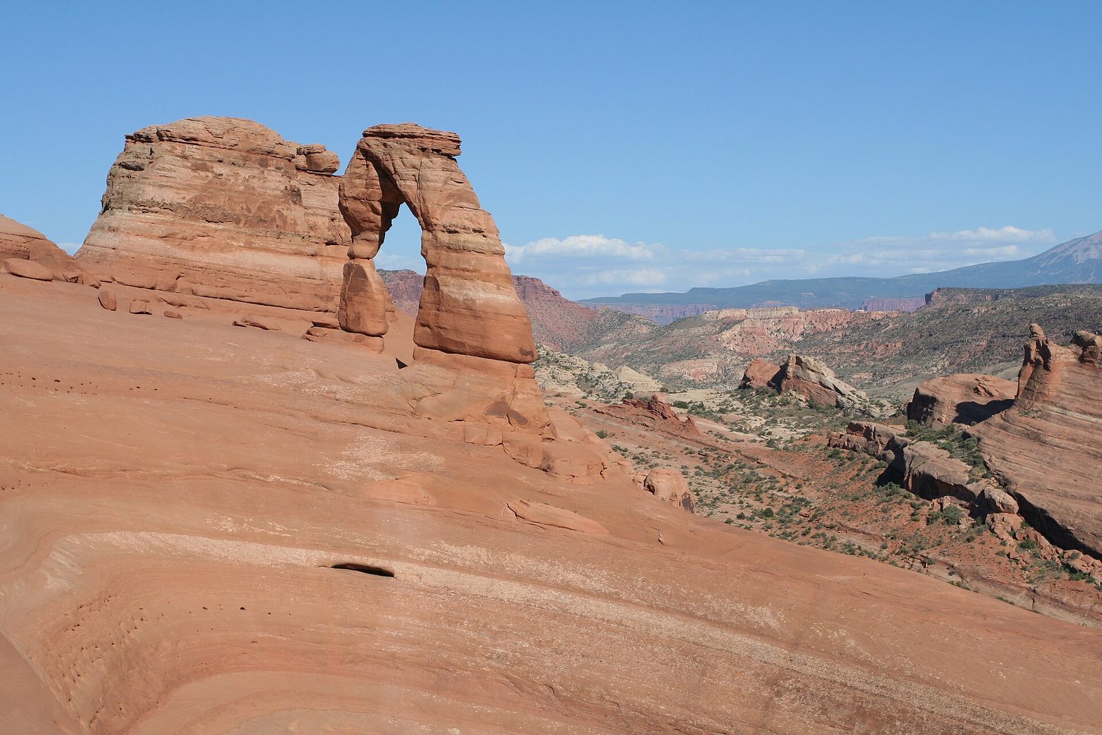
Moab base — Arches & Canyonlands Region base — two parks, one pillow
Strengths
- The efficient end of the region: one base town serves two parks — Arches, the dense field of stone arches with Delicate Arch as its emblem, and Canyonlands' Island in the Sky district, the high mesa of river overlooks
- For 2026 the entry question is simpler than older guides say: the Park Service has lifted Arches' timed-entry reservation for this year — entry runs on a valid entrance pass during operating hours, with no advance slot to win
Watch out
- "No timed entry" is not "no planning": reservations still govern the Devils Garden Campground and the Fiery Furnace hikes at Arches, and the park warns that congestion itself can slow or pause entry on the busiest days — early starts are the structure now
- Canyonlands is four separate districts with no roads joining them inside the park: a Moab base serves Island in the Sky honestly, and the other districts are their own expeditions, not a longer afternoon
- Moab is a small town carrying a famous region: in peak season its rooms and restaurants are the bottleneck, booked on the town's calendar, not the parks'
Best for: the first park block of the arc — two parks from one base while the trip is still fresh.
Read the NPS 2026 Arches announcement →Official siteTorrey base — Capitol Reef Region base — the quiet park
Strengths
- The arc's hinge and its quietest park: Capitol Reef protects the Waterpocket Fold, the long wrinkle in the earth's crust that the state itinerary uses as the bridge between Moab and Bryce — orchards in a pioneer valley under reef walls
- It is also the drive's reward in itself: the road from Moab to Torrey and onward along Scenic Byway 12 toward Bryce is part of the official itinerary's structure, not a transfer to endure
Watch out
- Torrey is a small gateway: fewer rooms and shorter evenings than Moab or Springdale, which is the charm and the constraint in the same fact — book the pillow before you plan the park day
- Byway 12 is a mountain road with a high summit: in winter conditions it is the leg of the arc to re-check against state road reports on the day, not the leg to assume
Best for: the middle night of the arc — the park completists rush past and slow travellers remember best.
See the official Mighty 5 itinerary →Official siteBryce Canyon Region park — the amphitheatre of hoodoos
Strengths
- The arc's high, strange garden: a rim of viewpoints over amphitheatres of eroded hoodoos, with trails dropping among them — the sunrise rim is the itinerary's set piece between Capitol Reef and Zion
- It works at two depths honestly: a rim-and-viewpoints stop on the through-drive, or a full day with a below-the-rim hike — the only park on the arc where both versions are complete experiences
Watch out
- Bryce is high country: its rim sits far above the desert parks on this arc, so winter arrives earlier and spring leaves later there — the same week can be T-shirt weather in Moab and snow at Bryce, and clothing is planned per park, not per trip
- Sunrise is the famous hour and the cold one; the viewpoint crowds gather exactly when the light does
Best for: one night minimum — an evening rim, a sunrise, a below-the-rim walk, then the road to Zion.
See the official Mighty 5 itinerary →Official site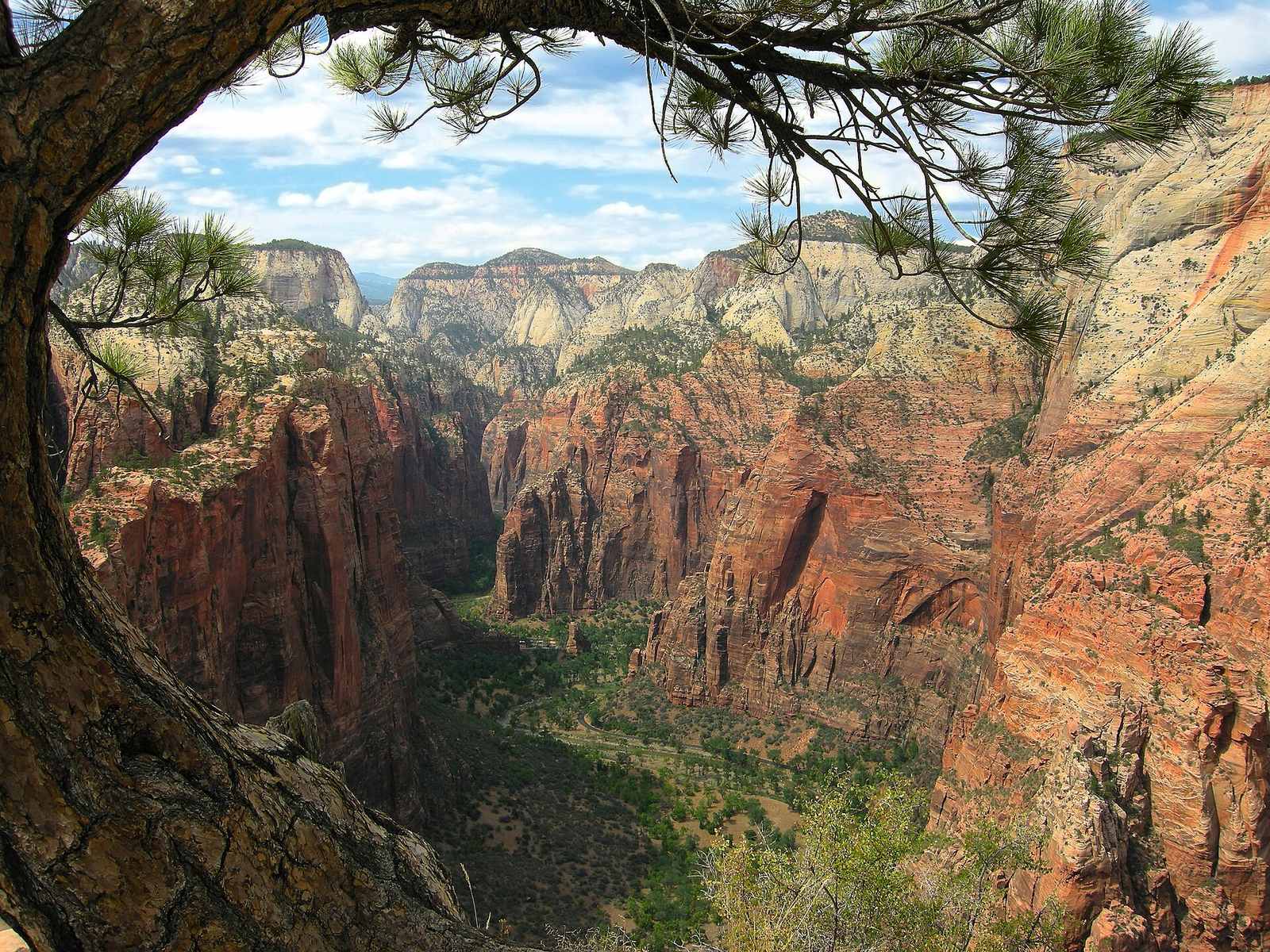
Springdale base — Zion Region base — the finale park
Strengths
- The arc's finale in the state's own ordering: a canyon deep enough to reorganise the trip around it, served from Springdale at its gate — the town the park shuttle system is built around
- The shuttle structure is the park's gift to planners: in season, the Zion Canyon Line runs the Scenic Drive through nine stops from the visitor centre to the Temple of Sinawava, the Springdale Line covers the town, riding is free and needs no reservation — and private cars simply do not use the Scenic Drive while the shuttles run
Watch out
- Angels Landing is a permit, not a plan: the chained section beyond Scout Lookout is allocated by lottery — a seasonal lottery ahead and a day-before lottery — through Recreation.gov, and Scout Lookout is as far as anyone goes without one
- The shuttle is seasonal down to specific no-service windows in the colder months on the park's published calendar: a winter Zion day is a different system (private cars return to the Scenic Drive when shuttles rest), so the NPS shuttle page is read for your exact dates
- Zion is the region's most visited park by a wide margin: Springdale's rooms price and fill on that fact, and the canyon's famous trailheads queue — the finale deserves the trip's most protected booking
Best for: the last park block — given the most nights of the arc, and the natural fly-out decision point (return to Salt Lake City, or exit via Las Vegas) at the trip's end.
See the NPS Zion shuttle page →Official site Browse Salt Lake City & Utah tours →Affiliate link — you pay the sameWhich version of the trip is yours?
The course in this hub's sense: the city in modules first, then the region in arcs. No drive times are stated anywhere — legs are named by direction and base, and your map on the day owns the hours.
Getting around — the free zone, the airport train, and the rental that matters
What about money?
Deliberately, this page carries no budget table and no stated prices — that is this hub's standing rule for city courses, because park passes, lotteries and rooms are priced per date by the parks and towns themselves. The structure worth knowing is simple: the city base is one of the cheapest downtowns in this hub to do well (a free square, a free transit zone, a free park shuttle at Zion), and the money concentrates in three places — the rental for the arc, the park entrance passes, and Springdale and Moab rooms in season. For worked numbers, our budget calculator builds example budgets for US trips — treat every figure there as an example to adjust, not a quote — and our travel cards comparison covers paying for it all without foreign-transaction surprises.
Decisions that actually matter
Can I visit the Mighty 5 as day trips from Salt Lake City?
No — and this is the question that saves trips. The state's own itinerary treats Salt Lake City as the start of a moving arc, with nights in Moab, Torrey, the Bryce country and Springdale. The parks are a southern region, not suburbs. Sleep in the city for the city; move your base for the parks. One park block (Moab, or Zion via its own base) is the honest version of a short trip.
Do I need reservations for Utah's national parks in 2026?
For general entry, the headline is Arches: the Park Service announced in February 2026 that Arches will not use timed-entry reservations this year — a valid entrance pass is what entry runs on. What still needs reserving is activity-level: Angels Landing's lottery at Zion, the Fiery Furnace hikes and Devils Garden Campground at Arches, and campgrounds across the five. Systems change by year and park; the NPS page for each park is the final word for your season.
Can I go inside the Salt Lake Temple?
Not yet. The temple has been closed for renovation since 2019, and the Church's plan is a public open house in April to October 2027, after which it is rededicated and closes to general touring again. In the meantime the square, gardens and the new visitors' centre are open — including a replica-room tour that shows what a temple's interior holds, by reservation through the Church's Temple Square channels.
How does the free transit downtown actually work?
UTA's Free Fare Zone covers much of downtown: trips on TRAX or fixed-route buses that start and end inside the zone are free. The airport is outside the zone — the Green Line ride in from the terminal is a fare trip that becomes free travel once you are moving within downtown. UTA's own pages carry the zone map and the current rules.
Where should I sleep — and how many bases does the full trip need?
Downtown inside the Free Fare Zone for the city nights: Temple Square on foot, the airport train at the door. Then one base per park block — Moab, Torrey, Bryce's gateway, Springdale — because the arc is a moving trip by design. Compare properties in our hotels comparison; this page's job is the geography, and the geography says five pillows is a feature of the full arc, not a flaw in it.
Prices and terms change often — the booking site is the final word. Park reservation systems, shuttle calendars, museum hours and transit timetables all change by season; check the operator's own page for your date. Facts on this page checked against official sources, November 2026.


